What is TcpMDT software?
TcpMDT Aplitop is a software that contains everything needed to process spatial dana, create a digital terrain model, plan roads and more. TcpMDT is a segment of Aplitop solutions designed primarily for civil engineers and surveyors.
The program works as an add – on on all known CAD platforms, as well as on GstarCAD. Iti s BIM software intended for civil engineers, surveyors, urban planners and ecologists working on civil engineering projects.
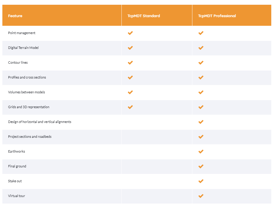
TcpMDT Standard
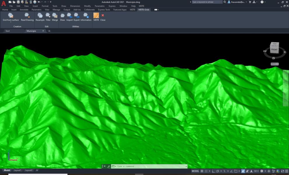
TcpMDT Standard allows you to create a digital terrain model using points measured by any device, GNSS receiver, file import or connection to web services. It offers options for generating lines, drawing profiles, cross – sections of terrain, calculating quantities (excavations and embankments ), visualization of terrain and infrastructure in 3D, maps, import and export of GIS files, etc.
TcpMDT Professional
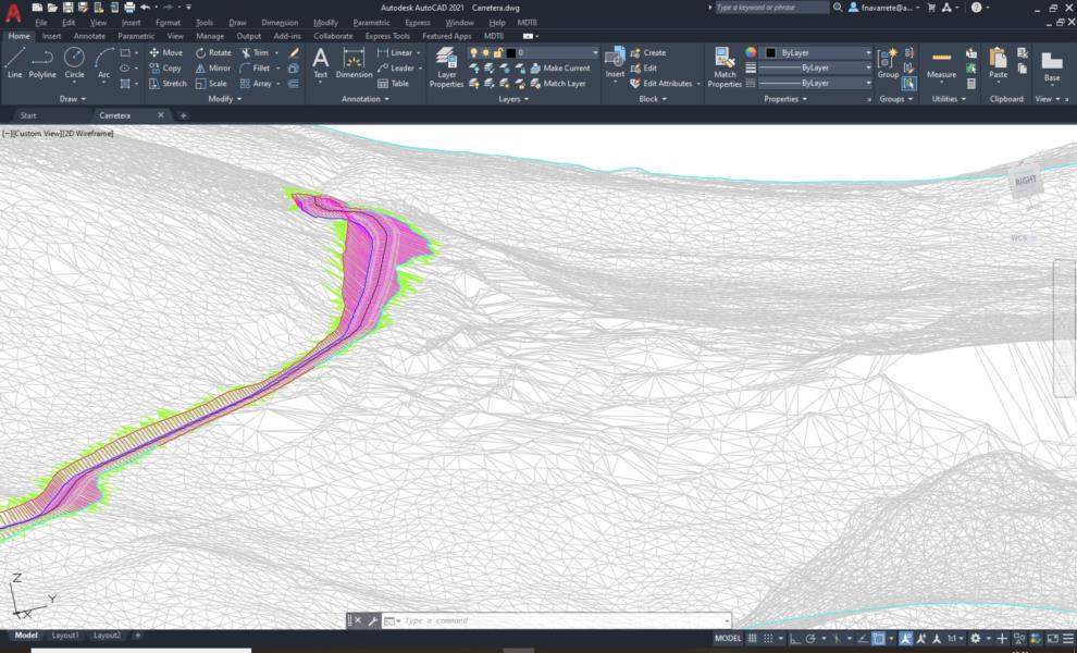
TcpMDT Professional includes all features of the standard version and offers tools for level and cross profile planning, project template drawing, area and volume reports, scheduling, virtual overview, volume measurements, plumbing, sewage, rainwater, etc. This software is suitable for all types of geodetic projects of roads, urbanization, quarries … By exchanging IFC and LandXML files, the project can be easily integrated into the OpenBIM workflow.
In the Professional version, the emphasis is on the possibilities of editing digital terrain models and road planning.
What are the possibilities of TcpMDT ?
The main features that TcpMDT provides to designers:
- Spatial data processing
- Development, editing and analysis of digital terrain models
- Road planning, excavations, quarries, etc.
- Development of 3D / BIM road models
Difference between TcpMDT Standard and Professional versions:
Slovenian users point out the following amazing features of TcpMDT Professional:
- Import and export of measured points
- Support for various formats (Leica, Riegl, FARO, LiDAR, ASTM, ASCII, MDT, Polygon, Topcon..)
- Import and processing of point clouds
- 3D terrain cross – sections
- Quantity list – analysis of materials and reports
- Automatic creation of road cross – sections by stations
- Development and editing of a digital terrain model (lines and other display methods)
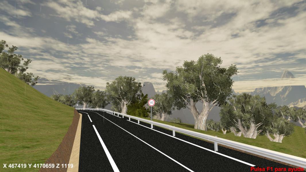
- Visualization of the project in 3D and in virtual reality
- Connection with Android apps, which are useful in the field
- Obtaining various data on excavations and embankments
- BIM compatibility, export and import IFC2x3, IFC4 in IFC4.1
- Integration with Navisworks software (osnova za BIM-5D in BIM-6D)
- Import data from WCS / WFS server
- Import and export as LandXML file
- Simple integration with CAD, BIM and GIS projects
- Drawing a route and the level or axis of a road (use of geometric elements, such as cross arch, clothoid…)
- Defining the cross section of the road (pavement, trough, lane, construction, etc.)
Other Aplitop applications
Aplitop products cover the entire area, from capturing spatial data from the air, processing, converting to accurate 3D models, photogrammetry and standard software tools important to modern surveyors. Aplitop is software from Spain that has been present on the market with its software solutions for more than 30 years and has extensive experience that has been implemented in software solutions for efficient and easy workflow.
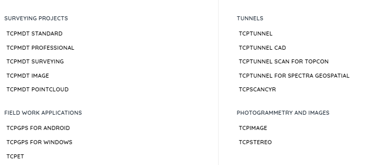
TcpMDT is compatible with a wide range of other Aplitop programs.
Try TcpMDT on your CAD platform with 30 – day free trial version.
If you don’t already have a reliable and affordable CAD software, download the demo version of GstarCAD.
GstarCAD is and increasingly popular software, we are sure you will be satisfied!
We are always available for additional questions and consultation!
